
ZIP Codes Serving Wildomar
Research identifies one regular ZIP code directly serving Wildomar. That finding matters because a ZIP code directory should not grow a list of nearby postal areas simply because a map places them close to the city. USPS assigns delivery routes, while Riverside County and Wildomar decide parcel and municipal questions. The table keeps those roles separate and records only the verified local result.
| ZIP | Areas Covered | Post Office | Notes |
|---|---|---|---|
| 92595 | Wildomar and the postal delivery area around the city | WILDOMAR Post Office, 21392 Palomar Street | Only verified regular Wildomar-serving ZIP; the postal area can extend beyond the city line. |
The official Wildomar Post Office result lists 21392 Palomar Street, Wildomar, CA 92595-9998, phone 951-678-9610, and counter hours Monday through Friday from 8:30 a.m. to 5 p.m. The general USPS number is 800-ASK-USPS. Those details identify the serving office. They do not draw the outer municipal boundary or prove that a person lives at an address.
The USPS Wildomar Post Office listing below is the source for the station details used in the Wildomar ZIP code directory.
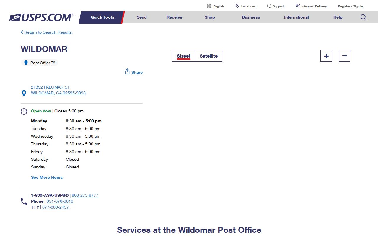
The post-office result confirms the serving location and its listed counter schedule. It does not define the complete 92595 polygon or replace a parcel-jurisdiction check.
There is no verified split or realignment date for Wildomar in the research, and no verified PO-box-only or unique ZIP for the city. Nearby ZIP codes are not added by proximity. A particular address must be checked with USPS, then checked against parcel jurisdiction when the question is about Wildomar records rather than mail delivery.
USPS Delivery, GIS Jurisdiction
USPS answers whether a delivery address is recognized within a postal route. The USPS ZIP Code by Address tool takes the street address, city, and state as delivery inputs. It is the right first check when an old street name, a rural description, or a copied address may be wrong. A successful postal match still says nothing about which agency holds a permit, deed, or planning record.
The USPS address-to-ZIP lookup shown here is the postal verification step for the Wildomar ZIP code directory.
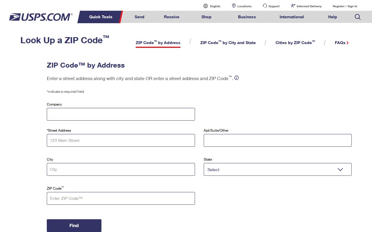
A delivery lookup can confirm the ZIP assigned to one address. It cannot show nearby parcels, city limits, or the people connected to a record.
Riverside County’s Map My County viewer supplies the second check. Its parcel, city and county boundary, district, ZIP, road, recorded-map, and environmental layers give geographic context. Map features are approximate and not a survey. Use the parcel and jurisdiction layers to decide whether a city or county office is the likely custodian, not to turn a postal label into a legal boundary.
Comparison point. USPS verifies deliverability; GIS verifies parcel context and jurisdiction. A ZIP code directory can narrow the search, but an APN and legal description carry the land record forward.
Finding Wildomar Residents by ZIP
A ZIP-level search works best as a staged filter, not as a promise of a public list of every person in 92595. The assessor portal supports property-address and APN work, but Riverside’s public web design does not offer an unrestricted owner-name directory. My Voter Status is an identity-gated self-lookup. An approved voter-file request has a separate legal purpose and is not a personal street or neighbor browse.
- Enter the deliverable address into USPS ZIP Code by Address. Confirm the five-digit ZIP and save the exact street spelling returned for the search.
- Open Riverside County Property Search and use the property address when a parcel fact is needed. Capture the situs address, APN, legal description, and any published assessment detail; do not expect a bulk resident export.
- Use Map My County with the address or APN. Turn on parcel and boundary layers, then identify the parcel and note the jurisdiction. The ZIP layer supplies context, while the APN supplies the exact parcel key.
- Use California My Voter Status only for the person who is completing its identity check. The form asks for first name, last name, date of birth, and either a California driver license or ID number or the last four Social Security numbers, with an option for not having those items.
- If the ZIP narrows the question to a street, continue with the Wildomar street directory for address-keyed records rather than treating the postal area as a people roster.
The result is a clean chain: postal match, parcel match, APN, then a custodian-specific record. It avoids the common error of treating a shared city label as proof of residence or legal jurisdiction.
Wildomar ZIP Search Fields
Map My County documents more than a map image. Its controls let a researcher move from a ZIP context to an exact parcel. The ZIP Code search choice is useful for narrowing the map, but the viewer does not create a verified ZIP-wide residents directory. Use the field that matches the evidence needed.
| Field or Control | Type | Required | ZIP Search Use |
|---|---|---|---|
| ZIP Code | Text search | No | Places the map in the postal area for context. |
| Address | Autocomplete or text | No | Zooms to a Wildomar street address. |
| APN | Text | No | Finds the exact parcel and gives a stable bridge to assessment work. |
| Layer list | Checkbox tree | No | Shows ZIPs, parcels, city boundaries, districts, roads, and recorded maps where available. |
| Identify | Map click | No | Opens parcel or feature attributes after the map is positioned. |
Other documented search choices include community, cross streets, legal description, assessor book and page, roadbook, supervisor, and coordinate input. Measure tools show distance or area, not a resident radius. Print and share controls preserve map context, while the underlying assessment or recorded document remains the authoritative record for its own subject.
For a current parcel, connect the GIS result to Riverside County Property Search. The assessor result can show APN, situs, legal description, values, property characteristics, and tax-rate area. It can also show a mailing destination where public, but a mailing address is not proof of who occupies the structure.
Three Wildomar Address Identities
A ZIP code directory becomes more accurate when the address is treated as three linked identities. Postal text is only one layer. The assessor and recorder may use a parcel key or legal description even when an old street string no longer matches a current label.
- Situs address
- The physical location of the land used by the assessor and GIS. It answers where the parcel sits, not where tax mail is sent.
- Mailing address
- The destination for assessment correspondence. It may be elsewhere and is evidence about correspondence, not proof of occupancy.
- Legal description
- The lot, block, subdivision, or metes-and-bounds description attached to the land record. It can bridge older address names.
- APN
- The county assessment and parcel number. It is the safest bridge between Map My County, the assessor, and deed research.
When an address is copied from a deed, permit, directory, or obituary, preserve every version. Search the postal form for deliverability, then carry the APN and legal description into the record system that can confirm ownership or a dated project. Do not collapse a mailing destination into a person’s physical location.
Wildomar ZIP Code Boundaries
Wildomar sits in southwest Riverside County along the I-15 corridor between Lake Elsinore and Murrieta. Edge addresses can carry a postal place name that does not match the responsible planning, permitting, or records office. A 92595 label therefore supports a delivery claim, but it does not by itself establish Wildomar city jurisdiction.
The safest boundary test is two-part. USPS verifies the address-to-ZIP relationship. Map My County or an official city boundary map checks the parcel against municipal and county layers. If the question concerns a permit, start with the date and jurisdiction. If it concerns a deed, use the APN and legal description. If it concerns a voter, use the person’s identity-gated result or an approved file channel.
- ZIP code
- A five-digit USPS delivery area used to route mail. It is not a parcel boundary or a city charter line.
- ZIP+4
- A longer postal code that adds four routing digits to a five-digit ZIP for more precise delivery handling.
- PO-box ZIP
- A postal assignment used for boxes at a post office. Research did not verify a PO-box-only ZIP for Wildomar.
- Unique ZIP
- A ZIP assigned to one large organization or a limited delivery point. No unique Wildomar ZIP was verified.
- Carrier route
- A smaller USPS delivery route within a ZIP. It is a mail-service unit, not a public list of households.
Historic Wildomar Postal Clues
Modern ZIP records do not reach back through the full Wildomar address story. The settlement was founded in 1886, Riverside County formed in 1893, and city incorporation took effect July 1, 2008. A historic person or parcel may be described through a railroad station, rural route, Elsinore-area reference, or a street name that is not the current postal form.
The city’s Historical Maps of Wildomar collection records why early land research crosses jurisdictions. Blocks K, L, and M were mapped in January 1885 and recorded with San Diego County in October 1885. The Collier and Graham townsite map was recorded in San Diego County on November 20, 1886, and the collection includes an 1887 Wildomar map and a 1890 San Diego County map. These maps help reconcile old street spellings and tract geometry when a current ZIP search cannot find the same land.
No authoritative comprehensive street-renumbering table or year was located. Keep the old legal description, subdivision, lot, block, and APN with the postal result. The ZIP code directory can point to the right area, but the land chain is what connects a historic Wildomar description to a present parcel.
Official ZIP Records Compared
Different offices may return different kinds of “address” evidence. The comparison below keeps the result tied to the question being asked and makes a failed search easier to diagnose.
| Question | USPS Result | County or City Result |
|---|---|---|
| Can mail be routed? | Address-to-ZIP assignment and serving office | Not the purpose of the parcel or city systems |
| Where is the land? | Postal area only | Situs, APN, parcel shape, and jurisdiction layers |
| Which record custodian applies? | Serving post office clue | City or county boundary and record date |
| Who is connected to a record? | No resident proof | Deed parties, assessment facts, permit participants, or approved voter data, each with limits |
The result is a narrower and more defensible Wildomar ZIP code directory: 92595 is the only verified regular local ZIP, nearby ZIPs are not inferred by distance, and every person or property question moves to the custodian that actually holds the evidence.